|

Day One: We left Golden the next day, with good weather to start with as we headed over Lookout Mountain Road into downtown Golden, stopping for some maps and a road condition report. We headed North out of Golden on 93 and then 72 towards Estes Park, through Pinecliff, Nederland and Raymond. We stopped for lunch in Estes Park and learned at the restaurant that Trail Ridge Road, through the pass, was covered in snow and slush and extremely hazardous for motorcycles. A local rider in the restaurant was very helpful and told us about a great road to Masonville that would get us closer to Granby Lake, our destination for the evening, without going across on Trail Ridge Road. Masonville Road, also labeled County Road 27, was beautiful, remote and for the most part devoid of traffic. We saw maybe two cars in each direction the entire time we were on the road. The road got us over to Highway 14 near Rustic, where we filled up the bikes with what must be the slowest suction pumps left in operation. The smiling United Parcel Service driver making deliveries at the store knew instantly what we were up to on our trip and made his envy known.
|
| 
|
| |
|
Mmmm! Fresh
pork.
|
|
|
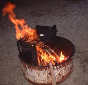
We took 14 west to Walden, and then dropped down on 125 to Granby and got to the campground as it was getting dark. We camped in a mostly empty campground at the headwaters of Granby Lake. There was firewood and we had undercooked pork and fresh cherries for dinner. The campground critters had some cherries too, quietly late that night.
| |
|
|
|  |
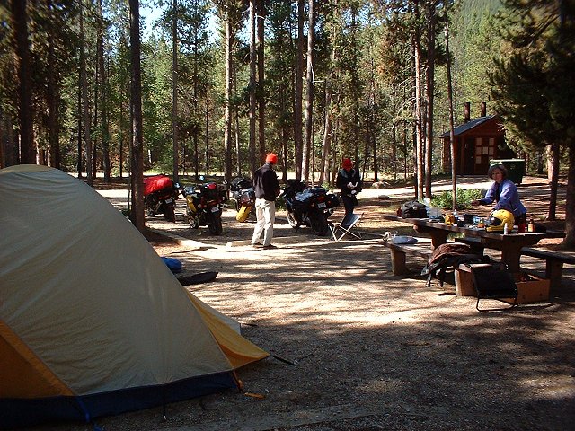
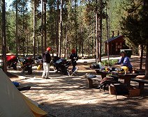
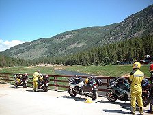
| Above,
the
morning campground scene. We
were the only occupants of this lovely wooded campground next to
Grandby Lake. Below,
suiting up and ready to leave the Granby Lake campground.
|
|
|
|
|
|
|
Day Two: That night was the coldest of the trip, and the bikes were covered with frost the next morning. Even Mark wasn’t hopping out of bed at the crack of dawn for a change. We had a leisurely camp breakfast, keeping warm by trying to capture a friendly hummingbird with the digital camera, but no joy. He seemed to be intrigued with Mark’s red hat and something deep in my ears. Perhaps earplug wax residue is a hummingbird delicacy.
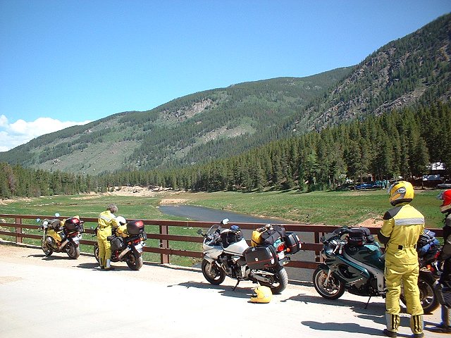
The gravel road out of the Granby Lake campground didn’t seem as long as it did coming in the evening before, and the sun had brought out the fisherman to try for trout in the headwaters. We took 40 East for just a bit, the same highway that would bring us back the entire width of Colorado on the last day of our trip. We jumped on 125 North through the Arapaho National Forest, the Routt National Forest and then through the Arapaho National Wildlife Refuge back to Walden, where we stopped for lunch. North of Walden the road forked and we took the east fork, 127, which crossed into Wyoming at Mountain Home. At the Wyoming line 127 becomes 230, which took us along the southeast corner of the Medicine Bow National Forest and then on to Laramie. After a quick stop at the local tourist information center, housed in a very stationary railroad caboose, we left Laramie on 130 West, also known as the Snowy Range Scenic Byway. The road cut right across the heart of Medicine Bow National Forest, and through Snowy Range Pass at 10,800 feet. The Bandit was the only carbureted bike and lost a little more crispness than I think the injected Guzzis or Sprint did, but the road and scenery were spectacular and traffic was light. Average speed: 85-90 mph. Mark often led the way with a non-functioning speedometer and he just revved the 90-degree twin until it felt right in 6th gear. The terrain gradually turned to sagebrush-dotted prairie-desert, and the prairie dogs stopped whatever they were doing to give us the hairy eyeball.
Route 130 gently turned North and took us through Saratoga and than on to Interstate 80 at Walcott. We planned to zoom west on I-80 to Sinclair, stock up on supplies, and leave the interstate on Seminoe Alcova Wyoming Backway to a campground 35 miles up the road at Seminoe Reservoir. The name Sinclair reminded me of the friendly green brontosaurus on the gas station signs when I was a kid, and sure enough, the town was basically housing for the refinery, which seemed to be operating at well below peak capacity and staff. The seemingly well planned town square was empty, save for a few non-profit storefront businesses. The “supplies” available in Sinclair consisted of beer, at the bar that seemed to be the only building in town containing live people. There was no grocery store, and we didn’t want to get back on the interstate, so we resigned ourselves to cold beer and freeze-dried dinner. The bar patrons were rude and creepy, and one followed us out to the parking lot. I asked him if the campground at Seminoe was nice or a windblown dustbowl (like Sinclair, I thought). He said “Only when the wind blows.” We skedaddled towards the campground and noticed the wind was indeed blowing. The road went through nowhere, and the only living things we saw were prairie dogs and small, cute antelope. A sign in the campground restroom warned that the cute prairie dogs carried plague. How medieval.
The campground was divided into two sections, separated by an arm of the reservoir. After checking both out and being bummed by all the dust on the gravel roads, we chose the mostly empty campground, which was lunar in its desolation. The wind was blowing at least 30 mph and never subsided the entire night, and we actually parked the bikes nose into the wind for fear they’d be blown over. We huddled in the camp shelter and fought to keep my ancient Svea 123 stove lit, and finally got to enjoy a tasty, soupy noodle concoction out of a foil bag. Bon
apetite. The sky seemed free of any atmosphere whatsoever, it was so clear and free from light pollution. The moon rose pale in the sky, seemingly the only proof that we weren’t actually camping on her surface.
|